Table of Contents
Save
When the user presses the Save button, this triggers the save behavior.
snapLocation
Setting snapLocation to the name of a geopoint question will create a popup to acquire the GPS location. This feature is only active when wizardMode is enabled.
| type | name | label |
|---|---|---|
| geopoint | f_location | Location |
| select_one animal | f_animal | Animal |
| text | f_note | Note |
| surveychoicessettings | ||
| title | bind::ct:save.snapLocation | |
|---|---|---|
| My form | f_location | |
| surveychoicessettings | ||
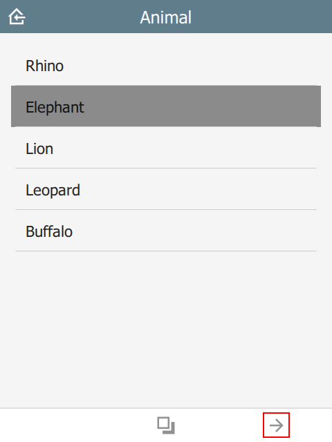
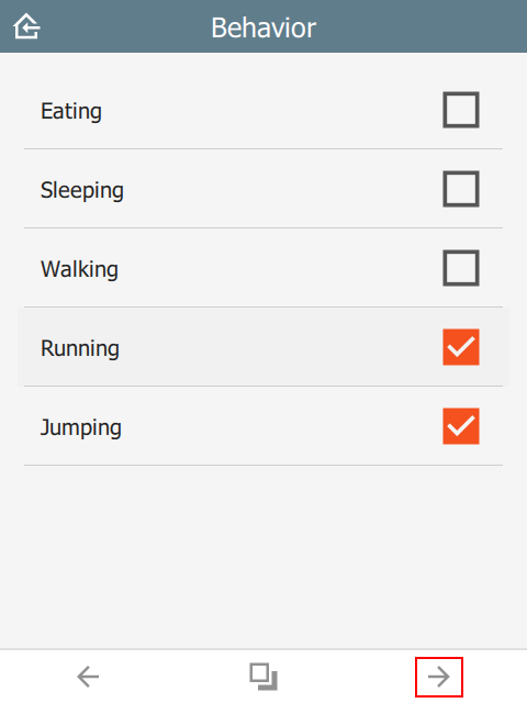
In this example, the user flow will be:
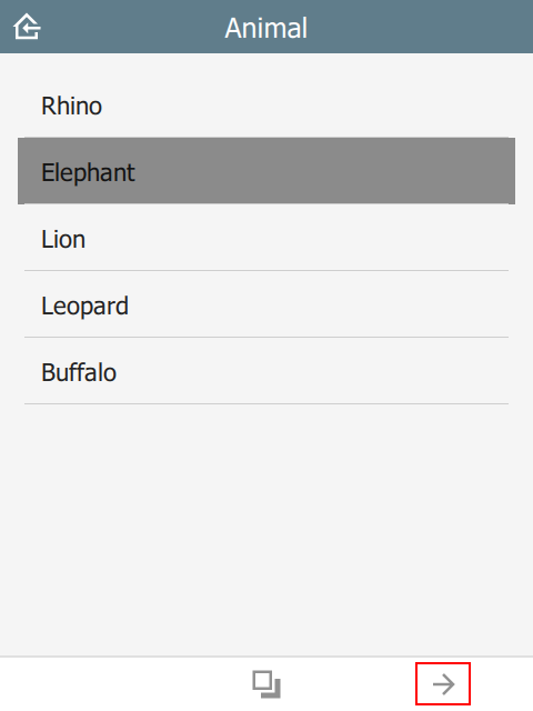 | 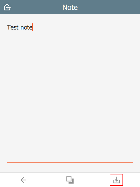 |  |
targets
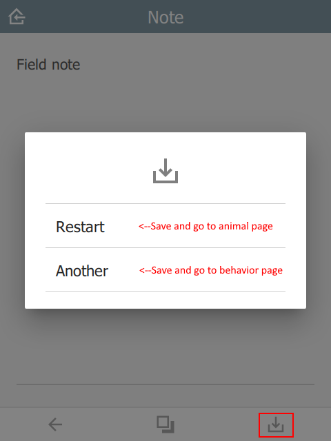
In the example below, the user will be presented with a popup containing the choices Restart or Another. After the sighting is saved, a new sighting will be created starting at the targeted question. All prior question data will be replicated into the new sighting.
This value must be a valid JSON array.
| type | name | label |
|---|---|---|
| select_one animal | f_animal | Animal |
| select_multiple behavior | f_behavior | Behavior |
| text | f_note | Note |
| surveychoicessettings | ||
restart and another are taken from the choices sheet in the saveTargets list name.
| list_name | name | label |
|---|---|---|
| saveTarget | restart | Restart |
| saveTarget | another | Another |
| surveychoicessettings | ||
Note that question is the name of the targeted question in the survey table. If the question is not relevant, then this choice will be hidden.
| title | bind::ct:save.targets | |
|---|---|---|
| My form | [{ "choice": "restart", "question": "f_animal"}, { "choice": "another", "question": "f_behavior"}] | |
| surveychoicessettings | ||
Note that if immersive is set to false, then the target list will automatically contain the home button. This option will save and return to the Home page without automatically creating a new sighting.
 |  |  |
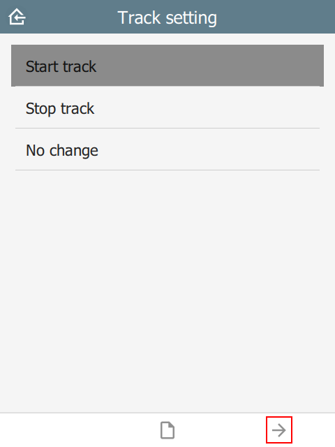
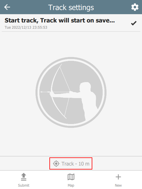
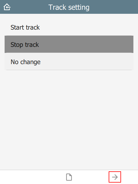
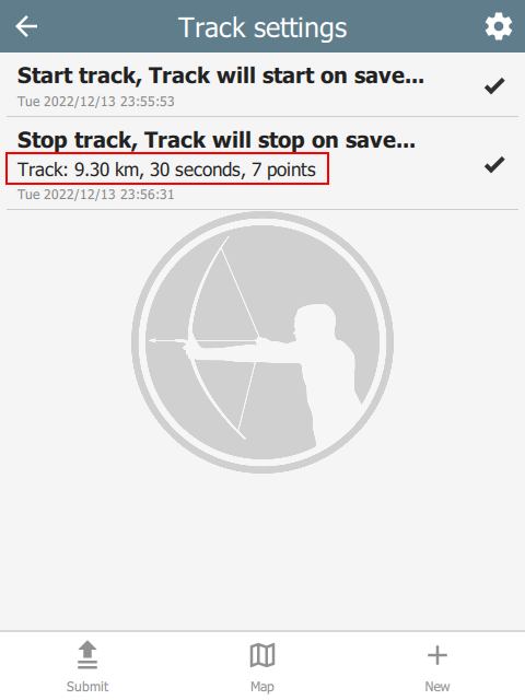
track
In the example below, there is a select_one question called f_track with choices start, stop and nochange. When the user presses Save, the track timer is adjusted depending on which choice was selected. The values in updateIntervalSeconds and distanceFilterMeters are the new track settings.
This value must be a valid JSON array.
| type | name | label | appearance |
|---|---|---|---|
| file | f_track_file | Track file | hidden |
| select_one track_items | f_track | Configure track | |
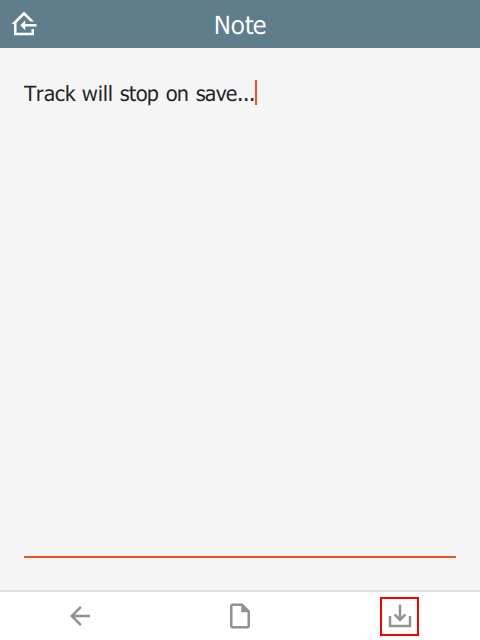
| text | f_note | Note | |
| surveychoicessettings | |||
| list_name | name | label |
|---|---|---|
| track_items | start | Start |
| track_items | stop | Stop |
| track_items | nochange | No change |
| surveychoicessettings | ||
| title | bind::ct:save.trackFile | bind::ct:save.track |
|---|---|---|
| My form | f_track_file | [{ "condition": "selected(${f_track}, 'start')", "updateIntervalSeconds": 5, "distanceFilterMeters": 10 }, { "condition": "selected(${f_track},'stop')", "updateIntervalSeconds": 0, "snapTrack": true }] |
| surveychoicessettings | ||
condition is an XlsForm expression which activates this option if matched, e.g. ${start_stop}=’start’. Check out the ODK Form Logic documentation.
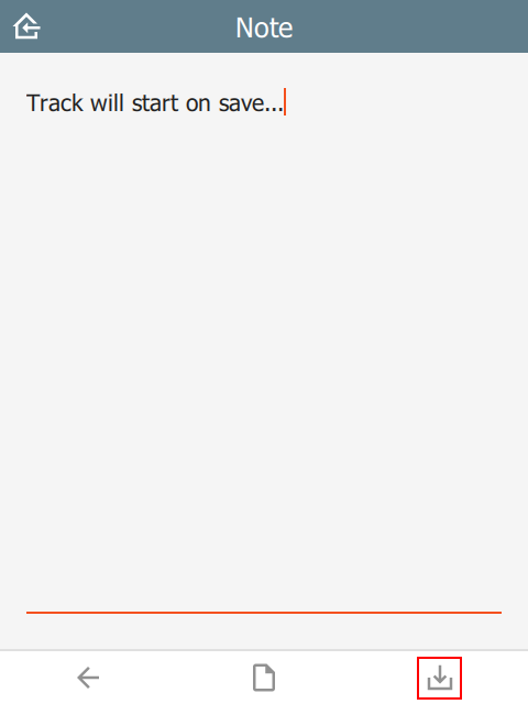
updateIntervalSeconds is the number of seconds between GPS readings. Set to 0 to disable the track timer.
distanceFilterMeters is the minimum distance between readings in meters. This is optional and by default no distance filter is used.
snapTrack causes the system to snapshot all the track points (since prior snap).
If using Survey123 and locationServiceUrl is specified, then the track data will be sent to the feature service. Otherwise, a track file will be created and added to a file type question in the form. See the section on the track file here.
 |  |  |
 |  |  |